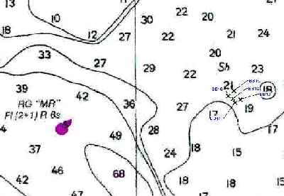
The Somerset Oyster Sanctuary near Crisfield, MD was constructed by the Maryland Department of Natural Resources in 2003. The area is closed to shellfish harvesting. The reef is constructed of oyster shells and concrete igloos which provide habitat for tautog, croaker, trout, flounder, porgy, striped bass, black sea bass, and other species. The reef area is located just east of MR buoy.
These are the coordinates for the boundaries of the sanctuary:
|
Point |
Lat. |
Long |
|
A
|
|
075 54.617 |
|
B
|
38 02.717 |
075 54.267 |
|
C
|
38 02.500 |
075 54.000 |
|
D
|
38 02.217 |
075 54.350 |
This close-up map of the coordinates shows how the reef lies.
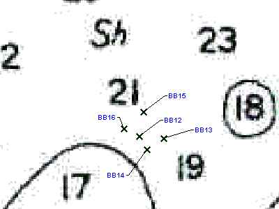
These are the coordinates the reef balls:
|
Name |
Lat. |
Long |
|
|
|
075 54.423 |
|
BB13
|
38 02.379 |
075 54.377 |
|
BB14
|
38 02.363 |
075 54.410 |
|
BB15
|
38 02.417 |
075 54.415 |
|
BB16
|
38 02.393 |
075 54.451 |
|
|
|
|