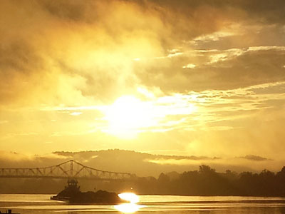
The Kanawha River is a tributary of the Ohio River. The river begins at the confluence of the New and Gauley rivers. The Kanawha flows approximately 97 miles before joining the Ohio River at Point Pleasant, West Virginia.
From the confluence to Charleston, the river is flanked by the Midland Trail National Scenic Byway (Rt. 60).
Near Glenn Ferris, Kanawha Falls is one of the most popular locations in West Virginia for catching walleye during their early spring spawning runs. Kanawha Falls Public Fishing Area provides access for fishing and other recreation.
A few miles downriver, the area near Loop Creek contains a variety of fishing attracting habitat including the creek outflow, rocky outcrops, shallow riffles, and a railroad bridge.
In Montgomery, a city-owned facility under the Rt. 61 bridge includes boat launching ramps and parking.
Navigation on the Kanawha River is controlled by a system of locks and gates that are maintained by the U.S. Army Corps of Engineers.
London Locks and Dam is located 82.8 miles above mouth of river and about 2 miles downstream from Montgomery, WV. It’s upper pool length extends approximately 7.8 miles to the river’s head of navigation.
Marmet Locks and Dam is located in Kanawha County, West Virginia, on the Kanawha River, a short distance above Charleston. The navigation pool stretches approximately 15 miles to London Locks and Dam.
Winfield Locks and Dam is located 31.1 miles above mouth of river at Winfield, WV. Its upper pool length 36.7 miles to Marmet Dam.
The R.C. Byrd Locks and Dam navigation pool stretches 41.7 miles along the Ohio River from the Racine Locks and 31.1 miles up the Kanawha River. R.C. Byrd Locks and Dam is located on the Ohio River approximately 9 miles downstream from Gallipolis, Ohio.
Kanawha River fish species include smallmouth bass, musky, walleye, sauger, channel catfish, flathead catfish, blue catfish, sunfish, suckers, and others.
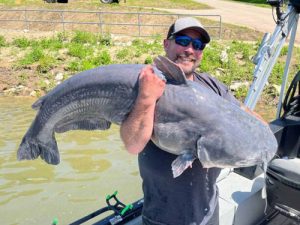
The Kanawha River is known for its monster blue catfish. In May 2025, Justin Connor set a West Virginia state record for length by catching a 51.49-inch, 66.30-pound blue catfish on the Kanawha River using a mooneye on 80-pound test line.